● 115,955 Flock cameras mapped

Your map shows traffic.
Ours shows who's watching.

Based Maps plots every mapped Flock camera in the US, then compares your drive: the fastest road, the road that passes the fewest cameras, and whether a zero-camera road exists — with exactly how many extra minutes it costs.

basedmaps.com/map

How based are the maps? Very.

Normal navigation optimizes for minutes. Based Maps also counts the cameras, so you can decide what a few minutes are worth.

◉

Every mapped camera

Over 115,000 Flock cameras from the public DeFlock US feed, drawn right on the map. Zoom in and see every one.

⇄

Routes, compared

Fastest vs. fewer cameras vs. misses-them-all — each with miles, drive time, arrival time and the exact camera count.

0

Zero-camera check

It tells you straight up whether a road with 0 mapped cameras exists, and how much longer it takes than the fastest.

⚑

Flock or all readers

Count only Flock Safety cameras, or flip to every mapped automatic plate reader.

◎

Search, locate, drop pins

Type a place with live suggestions, use your location, or drop the start and end right on the map. Swap in one tap.

✦

Ask Grok

"Route me to Steak n Shake nearby without passing Flock cameras." The Based Maps connector answers inside Grok.

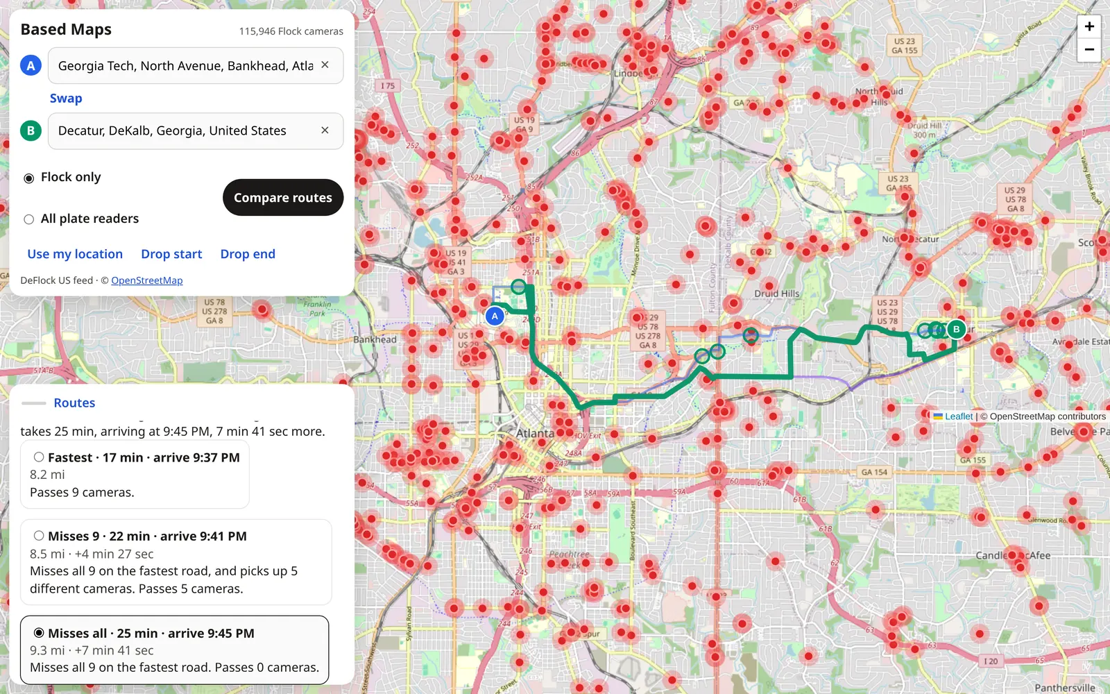
Based Maps comparing three routes from Georgia Tech to Decatur: fastest passes 9 cameras, one passes 5, one passes 0
Real trip · Georgia Tech → Decatur, GA

Nine cameras, or seven minutes. Your call.

The fastest road passes 9 mapped Flock cameras. Based Maps found one that misses all of them for about seven extra minutes.

Fastest · 17 min · 8.2 mi9 cameras
Fewer · +4 min · 8.5 mi5 cameras
Misses all · +7 min · 9.3 mi0 cameras
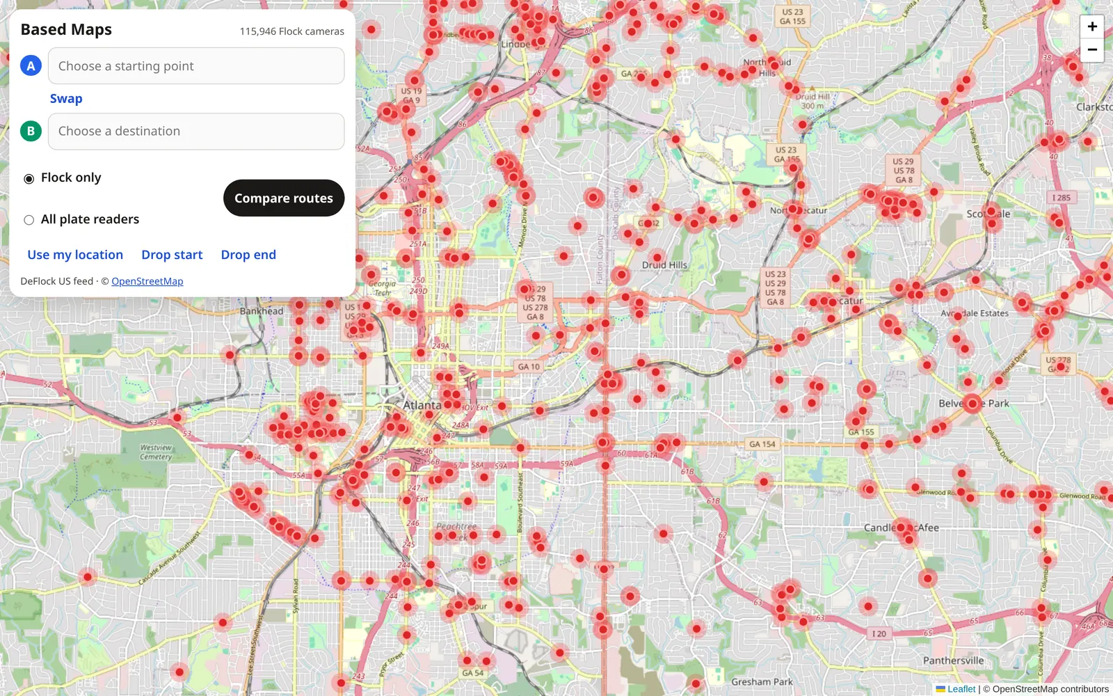
Dense red dots marking mapped Flock cameras across Atlanta
The camera layer

See the grid you've been driving through.

Each red dot is a mapped plate-reading camera. In a lot of cities it's not a few — it's a mesh.

  • Public DeFlock US feed, © OpenStreetMap contributors (ODbL)
  • Refreshed automatically every day
  • Within 60 meters of the road counts as passing one
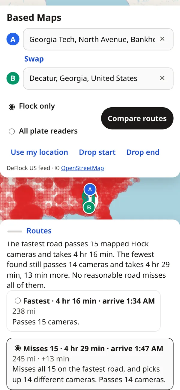
Based Maps on a phone showing a route comparison
On your phone

Built for the passenger seat.

The map works in any mobile browser — no app, no account, no sign-up. Tap Use my location, pick a destination, compare.

Open the map →

Grok connector

Ask Grok. It checks the cameras.

The Based Maps connector is an MCP server that gives Grok one tool, compare_drives. Grok gets back the fastest road, the fewest-camera road, whether a 0-camera road exists, the stops to follow, and a Google Maps link.

https://basedmaps.com/mcp
  1. In Grok, add a custom connector (MCP server).
  2. Paste https://basedmaps.com/mcp as the server URL. No API key needed.
  3. Ask for a drive: "Use Based Maps to take me to Steak n Shake." For "nearby," share your location.
compare_drives · start: "Georgia Tech, Atlanta" · end: "Decatur, GA"
Based Maps connector · real runCompared drives from Georgia Tech, North Avenue, Bankhead, Atlanta to Decatur, DeKalb, Georgia.

Fastest road: 17 min, 8.2 mi, passes 9 mapped Flock cameras.
Fewest cameras: 25 min, 9.3 mi, passes 0 mapped Flock cameras, 8 min longer than the fastest.
Zero mapped cameras: yes, 25 min, 8 min longer than the fastest.

Roads:
• Fastest: 17 min, 8.2 mi, 9 cameras
• Misses 9: 22 min, 8.5 mi, 5 cameras
• Misses all: 25 min, 9.3 mi, 0 cameras

Plus 8 stops along the 0-camera road and a Google Maps link to follow it. Times use typical road speeds; live traffic isn't included.

Real example, run Oct 19, 2026. Camera counts change as the map data updates.

Drive based.

Free, in your browser, right now.

Open the map →